1. Accueil
  2. Africa

Congo-Brazzaville satellite images

Soumouna

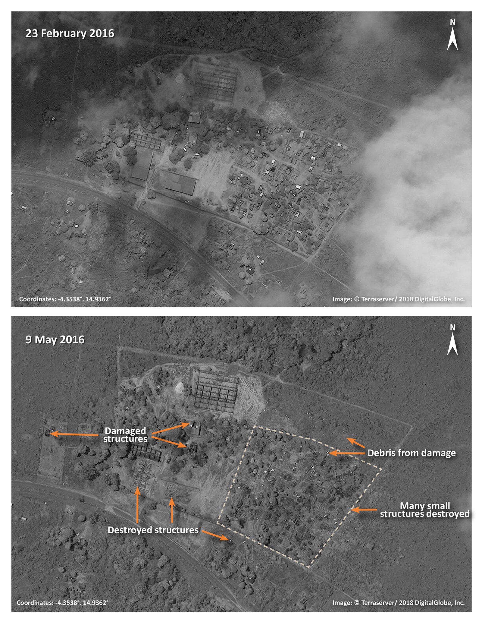
Imagery from 23 February 2016, shows a section of Soumouna with small and large structures visible. The area could possibly be for government purposes. On 9 May 2016, many of the small structures appear destroyed. The larger structures have also been damaged or destroyed. Debris from the damaged structures is visible throughout the area.

Kindamba Gouéri

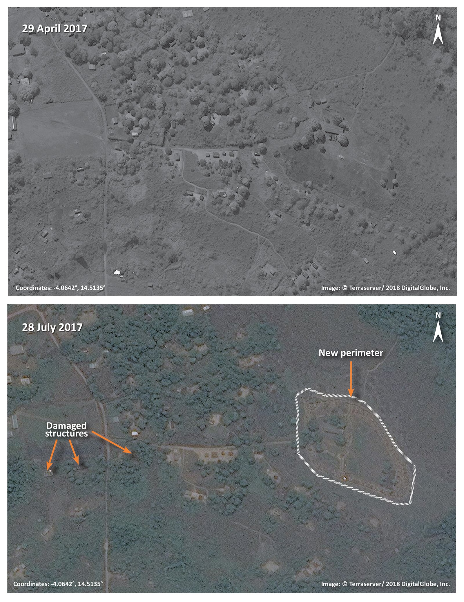
On 29 April 2017, Kindamba Gouéri appears intact. On 28 July 2017, a new trench-like perimeter has been built and multiple structures appear damaged west of the new perimeter.

Mayama

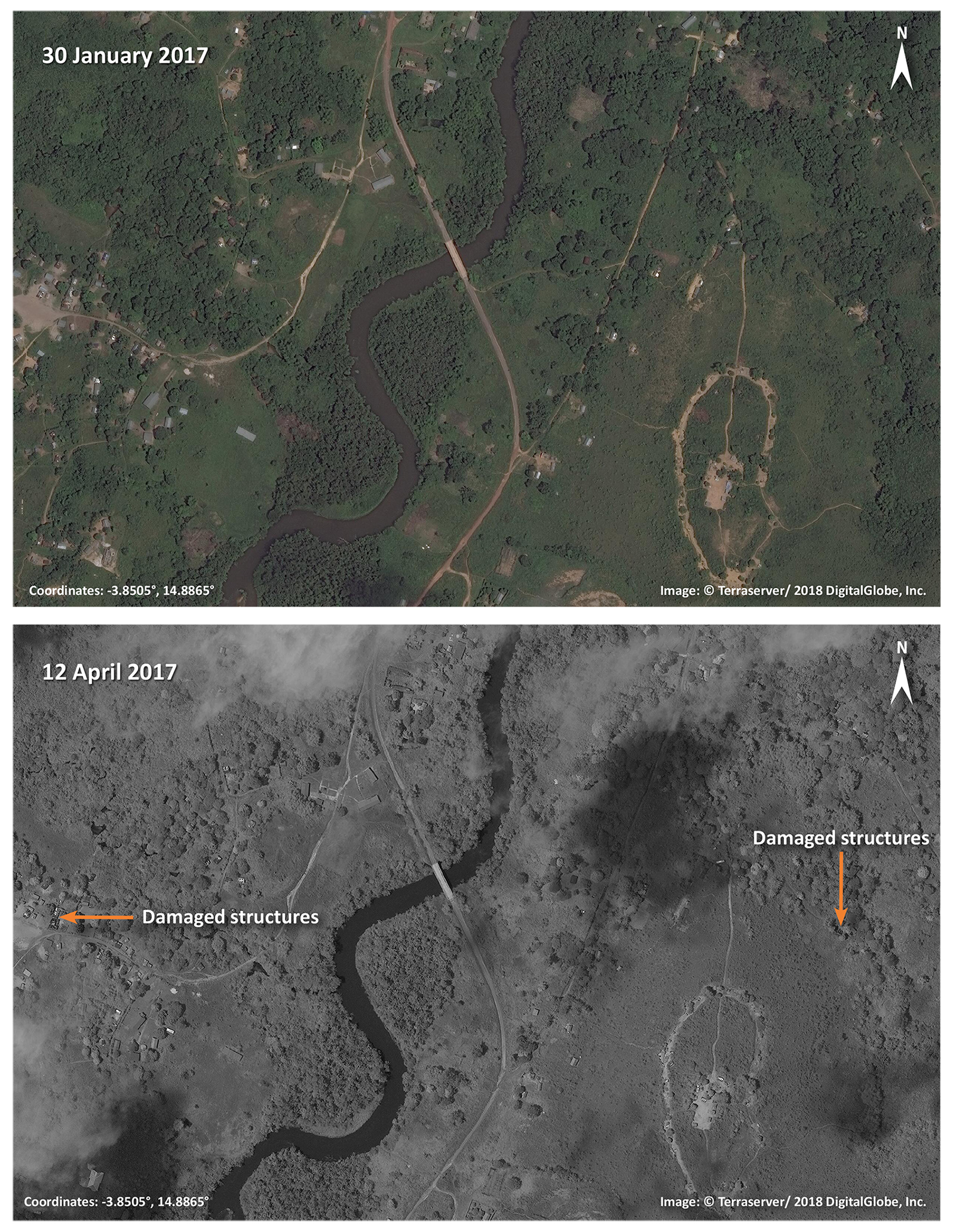
Imagery from 30 January 2017, shows a part of Mayama. By 12 April 2017, multiple structures in the town appear damaged.

Malengo

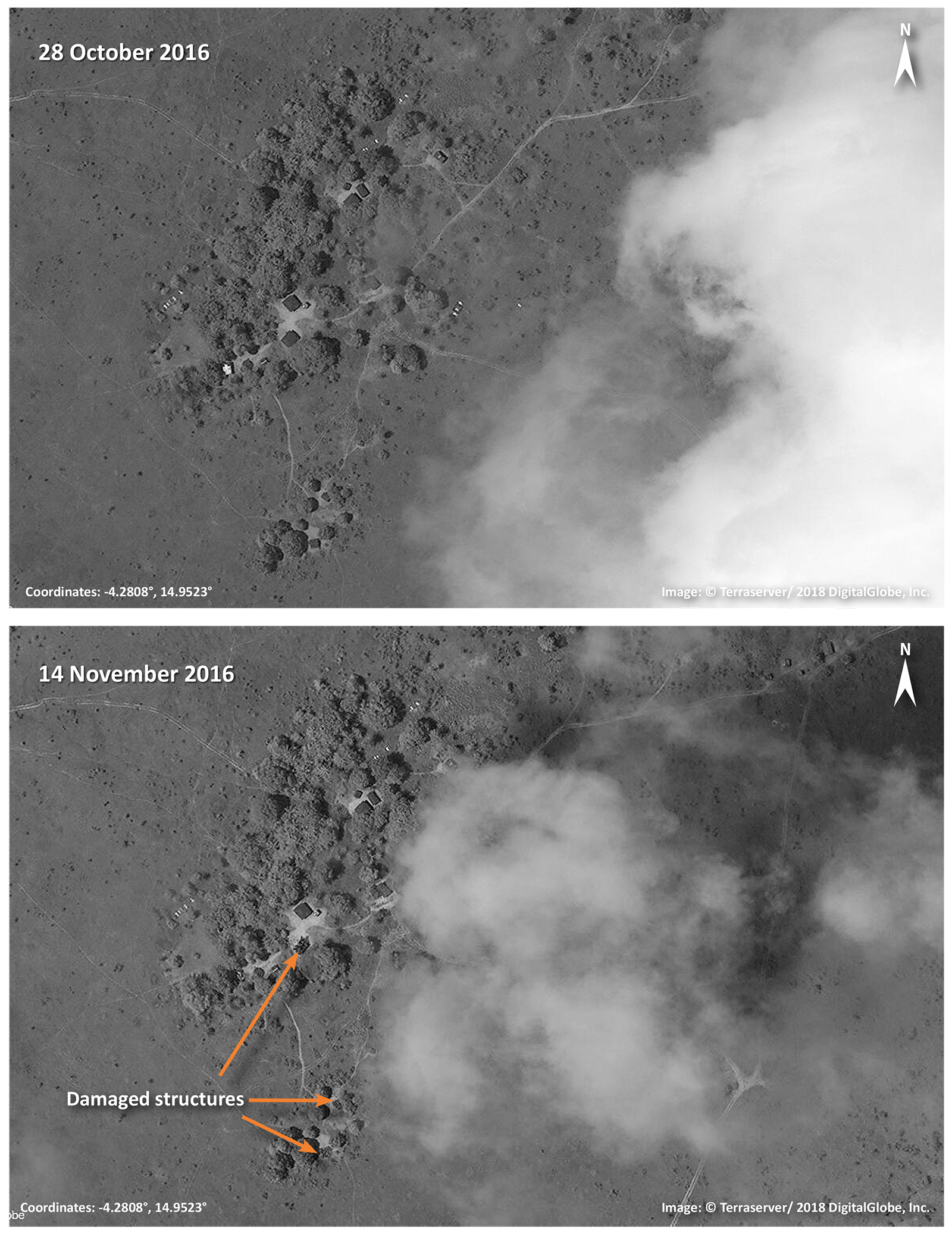
On 28 October 2016, the village of Malengo appears intact. On 14 November 2016, three structures appear damaged. Cloud cover in both images inhibits a complete analysis of the village area.

Partager cet article

Get the day’s top headlines in your inbox every morning

Starting at just $5 a month, you can become a member of The New Humanitarian and receive our premium newsletter, DAWNS Digest.

DAWNS Digest has been the trusted essential morning read for global aid and foreign policy professionals for more than 10 years.

Government, media, global governance organisations, NGOs, academics, and more subscribe to DAWNS to receive the day’s top global headlines of news and analysis in their inboxes every weekday morning.

It’s the perfect way to start your day.

Become a member of The New Humanitarian today and you’ll automatically be subscribed to DAWNS Digest – free of charge.

Become a member of The New Humanitarian

Support our journalism and become more involved in our community. Help us deliver informative, accessible, independent journalism that you can trust and provides accountability to the millions of people affected by crises worldwide.

Join